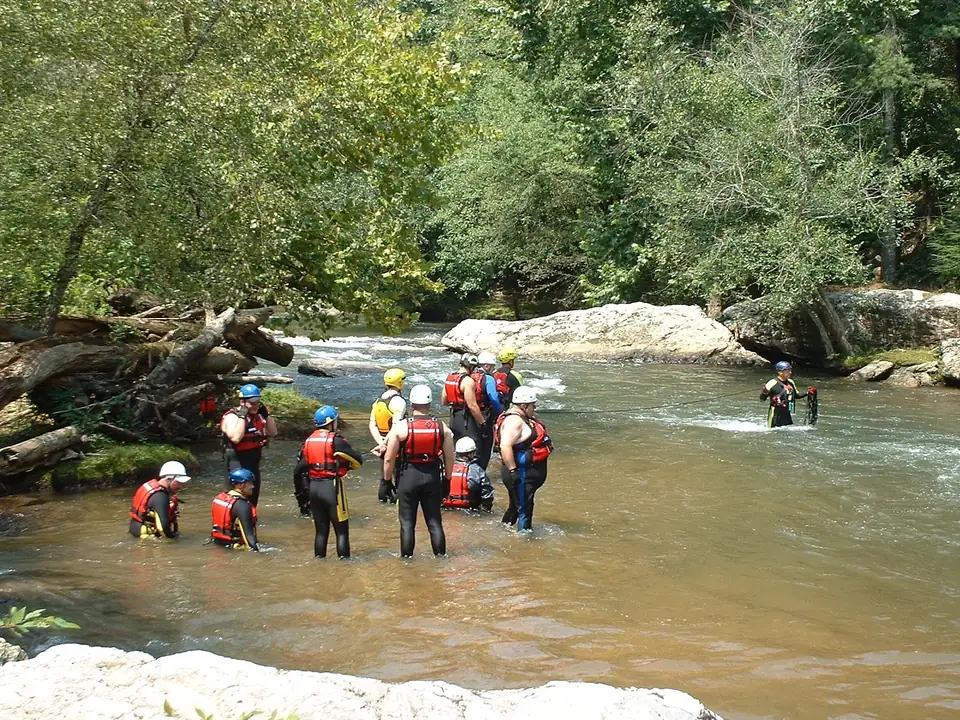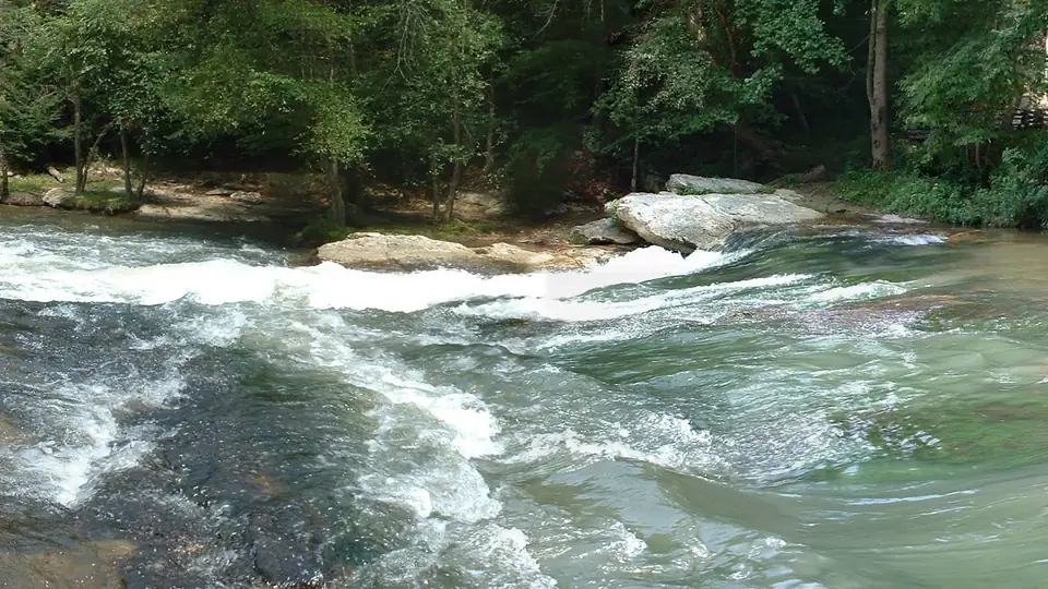
Blackberry Falls is the last rapid on the Middle Cartecay, and the Mulkey Road take-out is just past the bridge below it on river right. That is how American Whitewater describes the spot, on the Cartecay River in Gilmer County, Georgia. It is at about river mile 9.1 on our measured profile. The confusing part is the name, because the same take-out goes by at least three.
One take-out, several names
| Name | Where you will see it |
|---|---|
| Stegall Mill Road | American Whitewater’s reach titles: the Middle Cartecay ends at “Stegall Mill Road” and the Lower Cartecay starts there |
| Mulkey Road take-out | American Whitewater’s own reach text, for the same spot |
| Blackberry Mountain Drive | The name OpenStreetMap gives the bridge |
| “Blackberry” | Shorthand taken from the rapid just upstream |
OpenStreetMap shows no road called Stegall Mill Road here, only a Stegall Road and a Stegall Mill Ridge nearby. AW’s section titles and its directions use different names for one place. On this site we call it the Mulkey Road take-out below Blackberry Falls, and our river map pin lists the other names.
Do not mix it up with a second “Blackberry” bridge. Blackberry Mountain Road crosses Clear Creek near its mouth, about 1.9 river miles farther down on our profile. Georgia Wild Trout says Clear Creek is stocked at that Blackberry Mountain Bridge (Georgia Wild Trout). It is a different bridge on a different stream.
Where it sits on the river
On our profile, measured for this guide from USGS 3D Elevation Program data along the mapped river, the Lower Cartecay Road bridge is at mile 6.9 and about 1,473 feet, and the Mulkey Road take-out is at mile 9.1 and about 1,417 feet. That is about 2.3 miles and 57 feet of drop, roughly 25 feet a mile by our numbers. AW lists the Middle Cartecay at 2.3 miles, Class I-II+ (III), with an average gradient of 28 feet per mile (American Whitewater). Our profile is lightly smoothed, which flattens drops like the falls, so the small difference is expected.
Below the take-out, AW’s Lower Cartecay runs Class II (III) for 4.7 miles to the WMA take-out (American Whitewater), the Georgia DNR launch at about mile 13.9 on our profile. Its one Class III rapid is Clear Creek Falls (American Whitewater).

Blackberry Falls by level
American Whitewater rates Blackberry Falls Class II, rising to Class III/III+ above 4 feet on the USGS gauge (American Whitewater). It is the last of six named rapids on the Middle Cartecay: Sexton’s, Rock Garden, Surfing Rapid, S-Turn, Whirlpool and Blackberry Falls (American Whitewater). AW warns that the river-right eddy at Whirlpool almost always holds wood or other debris (American Whitewater).
| Gauge reading (USGS 02379500) | What the source says |
|---|---|
| Below 1.8 ft | Below American Whitewater’s recommended range for the Middle Cartecay |
| 1.8 to 6 ft | AW’s recommended range for the Middle Cartecay |
| 2.2 ft and up | Bottom of AW’s recommended range for the Lower Cartecay |
| 2.4 ft and up | AW says it is worth continuing past Mulkey Road to the DNR take-out |
| Above 4 ft | Blackberry Falls and Whirlpool become Class III/III+ (AW); S-Turn is Class III at 4 to 6 ft |
| 6 ft | Top of both AW ranges; NWS bankfull and action stage |
The ranges come from American Whitewater’s Middle and Lower reach pages and its note on the DNR take-out. The 6-foot line is from the National Weather Service. These are AW’s classes and ranges for whitewater paddlers. Whether a trip goes is your call or the outfitter’s, and our piece on what the gauge number means explains how to read them.
Parking and the summer closure
AW says parking at the Mulkey Road take-out is limited and that the lot is closed Friday through Monday from May 15 to September 15 (American Whitewater). That text sits on AW’s Middle Cartecay page, whose reach information was last updated April 28, 2023, so check for posted signs before you leave a car.
We could not confirm who owns the lot. No county or state source we found calls it public access. AW says the stretch above it runs through a residential area with private banks (American Whitewater), and it asks paddlers to keep groups small and quiet and not to put on after dark (American Whitewater). If you need a take-out that an official source confirms is public, it is the DNR launch on the Rich Mountain WMA Cartecay Tract, about 4.8 river miles below; our river access page has directions.
The top of the run has its own problem. AW’s Middle Cartecay put-in is the Lower Cartecay Road bridge, where the river-left put-in is managed by a commercial outfitter (American Whitewater). A trip report and OpenStreetMap both say that bridge is out, and we could not confirm that it has reopened. Do not plan a route that drives across it.
Check the shoals, not only the gauge
The gauge is about 8.2 river miles below the take-out. AW cautions that it is downriver of the runs, so whether the level is rising or falling matters, and suggests checking the shoals at the Mulkey Road take-out when the reading is near the minimum (American Whitewater). The shoals show you what the gauge, miles downstream, may not. The live reading and the trend are on water levels and safety.
Rentals are a separate thing
Cartecay River Experience runs its own floats. Its Adventure float puts in at 1554 Lower Cartecay Road (Cartecay River Experience), runs about 3 miles and includes Class 1 and 2 whitewater (Cartecay River Experience). The outfitter has not published its take-out location in what we read, so do not assume it is this one. If you have your own tube or kayak, it sells shuttle seats at $7 cash or $10 by card, as listed on its website and checked October 18, 2026 (Cartecay River Experience). Its season runs Memorial Day to Labor Day; see our kayaking and paddling page.
The Stegall Mill
The Stegall name is old. The New Georgia Encyclopedia shows a 1939 photograph of the Stegall Mill, which milled both lumber and wheat beside the Cartecay (New Georgia Encyclopedia). Its caption spells the river “Caretecay.” The encyclopedia does not say exactly where the mill stood, so we will not pin it to this bridge. The name lives on in AW’s reach titles all the same.
Questions people ask
Is the Mulkey Road take-out the same as Stegall Mill Road?
Yes, for paddling purposes. American Whitewater titles its Middle Cartecay as ending at Stegall Mill Road, while its reach text puts the take-out at Mulkey Road, just past the bridge below Blackberry Falls on river right. OpenStreetMap names that bridge Blackberry Mountain Drive.
Source: American Whitewater, checked Oct 18, 2026
What class is Blackberry Falls on the Cartecay?
American Whitewater rates Blackberry Falls Class II, rising to Class III/III+ above 4 feet on the USGS Cartecay gauge. It is the last rapid of the Middle Cartecay.
Source: American Whitewater, checked Oct 18, 2026
Can you park at the Mulkey Road take-out?
American Whitewater says parking there is limited and the lot is closed Friday through Monday from May 15 to September 15. We could not confirm who owns the lot or that it is public access.
Source: American Whitewater, checked Oct 18, 2026
Written by the Cartecay River Guide Editorial Team. AI tools help us draft; people check every fact before it publishes.