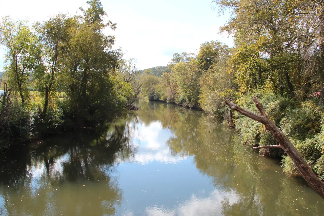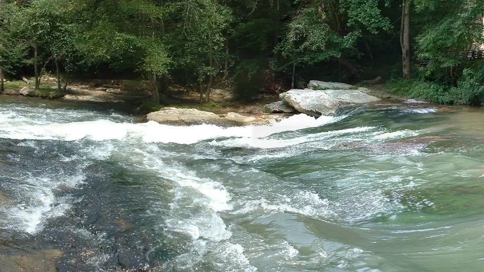
The Cartecay River begins in eastern Gilmer County, Georgia, where Tickanetley Creek and Rolston Creek run together. The USGS place-name database, GNIS, puts the Cartecay’s upper end and the mouth of Tickanetley Creek at the same point, about 34.6723 N, 84.3363 W. The river ends about 19 miles to the west in downtown Ellijay, where it meets the Ellijay River and the Coosawattee River begins. From top to bottom it falls roughly 340 feet.
That is a short answer to a question with a lot of bad information around it. Pages online start the river at White Path, give it a mouth elevation that cannot be right, or credit it with a drop of thousands of feet. We walked the river on the map from one end to the other and checked each number against USGS.
The start: two creeks meeting
GNIS places the mouth of Rolston Creek at that same point, so the Cartecay is formed by the joining of Tickanetley and Rolston creeks (USGS GNIS). The ground there sits at about 1,579 feet, according to the USGS 3DEP elevation service.
Rolston Creek starts much higher. USGS elevation data put its GNIS source at about 2,989 feet (USGS 3DEP), and that source lies inside the Rich Mountain Wilderness of the Chattahoochee-Oconee National Forests, per Forest Service map data. So the headwaters touch national forest. The Cartecay itself runs mostly through private land, and the confluence where it begins has no public access.
White Path is a real community, but it is not on this river. GNIS puts White Path at 34.7504 N, 84.4130 W, about 8 km north of the Cartecay in the Whitepath Creek valley (USGS GNIS). The community actually named Cartecay is about 2.5 km south of the river, off Highway 52 (USGS GNIS).
The measured profile, mile by mile
For this guide we pulled ground elevation every quarter mile along the river’s mapped line from the USGS 3D Elevation Program. Our line runs 19.2 miles from its upstream end to the Ellijay confluence, and the ground along it falls from about 1,572 feet to about 1,234 feet, a drop of about 338 feet. The river is usually given as 19.1 miles long; Wikipedia cites the USGS National Hydrography Dataset for that, but we could not read the figure on a USGS page, so we say “about 19 miles.”
- 0.0river mileTickanetley-Rolston confluence (head of the Cartecay) Tickanetley and Rolston creeks join and the Cartecay begins (USGS GNIS). Private land.
- 4.1river mileHolt Bridge Road bridge over the Cartecay
- 5.5river mileHighway 52 East bridge over the Cartecay (near Cartecay community)
- 6.9river mileLower Cartecay Road bridge (American Whitewater Middle Cartecay put-in) American Whitewater's Middle Cartecay put-in; the river-left put-in is run by a commercial outfitter.
- 9.1river mileMulkey Road take-out at the Blackberry Mountain Drive bridge (Stegall Mill Road / "Blackberry") Take-out below Blackberry Falls per American Whitewater; parking limited, ownership not confirmed.
- 11.0river mileClear Creek confluence (base of Clear Creek Falls) Clear Creek joins; upstream of here the watershed is Primary Trout Waters.
- 13.9river mileRich Mountain WMA: Cartecay Tract canoe/kayak launch (DNR / "WMA take-out") Georgia DNR canoe/kayak launch on the Rich Mountain WMA Cartecay Tract: the one public launch an official source confirms. License or Lands Pass required.
- 17.3river mileUSGS gauge 02379500, Cartecay River near Ellijay USGS 02379500, the flow reading on this site.
- 19.2river mileCartecay-Ellijay confluence (start of the Coosawattee River) Meets the Ellijay River; the Coosawattee begins.
| River mile | Place | Ground elevation |
|---|---|---|
| 0.0 | Tickanetley and Rolston creeks join | 1,572 ft |
| 4.1 | Holt Bridge Road bridge | 1,505 ft |
| 5.5 | Highway 52 East bridge, near the Cartecay community | 1,489 ft |
| 6.9 | Lower Cartecay Road bridge (American Whitewater’s Middle Cartecay put-in) | 1,473 ft |
| 9.1 | Mulkey Road take-out, just below Blackberry Falls | 1,417 ft |
| 11.0 | Clear Creek comes in | 1,357 ft |
| 13.9 | Georgia DNR canoe and kayak launch, Rich Mountain WMA Cartecay Tract | 1,301 ft |
| 17.3 | USGS gauge 02379500 | 1,255 ft |
| 19.2 | Ellijay River confluence, start of the Coosawattee | 1,234 ft |
The average works out to about 17 to 18 feet per mile. That is our own arithmetic from the USGS start and end figures: 1,579 minus 1,240 is 339 feet, spread over about 19 miles. Our measured profile gives nearly the same answer, 338 feet over 19.2 miles.
The average hides the shape. The first 6.9 miles, down to Lower Cartecay Road, fall about 99 feet, roughly 14 feet a mile. The next 4.2 miles or so, from Lower Cartecay Road to Clear Creek, fall about 116 feet, close to 28 feet a mile, and that is where the rapids are. American Whitewater lists its Middle Cartecay at an average gradient of 28 feet per mile. Below the DNR launch the river flattens again, falling about 67 feet in the last 5.2 miles to Ellijay.
The steepest single quarter mile in our profile, about 15 feet of fall, ends right at Clear Creek. American Whitewater describes Clear Creek as joining the Cartecay at the base of Clear Creek Falls (American Whitewater), so the map and the paddlers agree. The profile is ground elevation at the mapped channel, lightly smoothed, so read any one quarter-mile figure as rough.
Clear Creek and the trout line
Clear Creek is the main tributary on the lower river. GNIS places its mouth at about 34.6273 N, 84.4385 W, below Blackberry Falls, and notes that it rises in Pickens County (USGS GNIS). Turkey Creek drains into Clear Creek, not straight into the Cartecay; its GNIS mouth point is on Clear Creek about 1.7 km from the river (USGS GNIS).
The Clear Creek mouth also marks a legal line. Georgia’s water-quality rules designate the Cartecay watershed upstream from the mouth of Clear Creek as Primary Trout Waters, and the river below it as Secondary Trout Waters (Georgia EPD rules). That matters for streamside building rules, and it is covered in our piece on trout fishing the Cartecay.
The public tract and the gauge
At mile 13.9 the river passes the Rich Mountain WMA Cartecay Tract, a 2,142-acre Georgia DNR property. Its canoe and kayak launch is the one public river access an official source confirms on the Cartecay, and you need a Georgia hunting license, fishing license or Lands Pass to use the tract. The details are on our river access page.
At mile 17.3 the river passes USGS gauge 02379500, “Cartecay River near Ellijay.” American Whitewater places it at the East Ellijay city limits on Highway 52, about a quarter mile east of the Highway 515 bridge (American Whitewater). Its daily record begins on March 17, 1937 (USGS). What the reading means is explained in what the gauge number means.
The end: one point, three rivers
GNIS places the mouth of the Cartecay at about 34.6915 N, 84.4835 W in Ellijay, the same point where the Ellijay River ends and the Coosawattee River begins (USGS GNIS). The City of Ellijay describes the town as lying between the Ellijay and Cartecay rivers, where they join to make the Coosawattee. At the mouth the Cartecay drains about 136 square miles (USGS).
The spot has history. The New Georgia Encyclopedia calls Ellijay “once a large Cherokee trading center” at this confluence (New Georgia Encyclopedia), and the City of Ellijay says the railroad bridge over the Cartecay was finished in 1884 (City of Ellijay). No official source publishes a public access point at the confluence itself. If you want to keep the three rivers straight, see Cartecay, Ellijay or Coosawattee.
Numbers you will see online, corrected
| Claim seen online | What USGS shows |
|---|---|
| White Path as the source | It begins at the Tickanetley and Rolston confluence; White Path is about 8 km north of the river |
| A mouth elevation of 575 ft | USGS gives 1,240 feet for its site at the mouth |
| A source elevation above 3,000 feet | About 1,579 feet at the confluence; the high numbers belong to the head of Rolston Creek (about 2,989 feet) |
| A drop of a couple of thousand feet | About 340 feet from start to finish |
| A 135-square-mile basin | 134 square miles at the gauge, 136 at the mouth |
The 575 ft figure, which appears in Wikipedia’s infobox, is impossible on its face. USGS lists the mouth at 1,240 feet (NGVD29) (USGS), and the gauge less than two miles upstream sits at a datum of 1,255.3 feet (USGS). A 575 ft mouth would put the river roughly 680 feet lower than the gauge just upstream. Even downtown Ellijay’s ground reads about 1,283 feet at the USGS reference point (USGS).
The basin size works the same way. USGS lists 134 square miles at the gauge (USGS) and 136 at the mouth, so the commonly quoted 135 is a rounding between two real figures, not a third measurement.
Where you can actually see it
Most of the Cartecay runs past private land, and a road bridge is not public access. The DNR launch at mile 13.9 is the confirmed public spot. The Lower Cartecay Road bridge has been reported out, so do not plan a drive across it. Our river map shows every station in the table above with its source.
Questions people ask
Where does the Cartecay River start?
The Cartecay begins in eastern Gilmer County, Georgia, where Tickanetley Creek and Rolston Creek join, at about 34.6723 N, 84.3363 W. USGS GNIS puts the Cartecay's upper end and the mouths of both creeks at the same point. It does not start at White Path, which is about 8 km north of the river.
Source: USGS GNIS, checked Oct 18, 2026
Where does the Cartecay River end?
It ends in downtown Ellijay, where it meets the Ellijay River. USGS GNIS records the mouths of the Cartecay and the Ellijay River and the source of the Coosawattee River at the same point, about 34.6915 N, 84.4835 W.
Source: USGS GNIS, checked Oct 18, 2026
How much does the Cartecay River drop?
About 340 feet. USGS elevation data give about 1,579 feet at the Tickanetley and Rolston confluence, and USGS lists 1,240 feet at the mouth in Ellijay. Over about 19 miles that averages roughly 17 to 18 feet per mile (our arithmetic), steepest between Lower Cartecay Road and Clear Creek.
Source: USGS, checked Oct 18, 2026
How long is the Cartecay River?
About 19 miles. It is usually given as 19.1 miles, citing the USGS National Hydrography Dataset, though we could not read that figure on a USGS page. Our own line, measured along the mapped river for this guide, comes to 19.2 miles.
Source: Wikipedia, checked Oct 18, 2026
Written by the Cartecay River Guide Editorial Team. AI tools help us draft; people check every fact before it publishes.