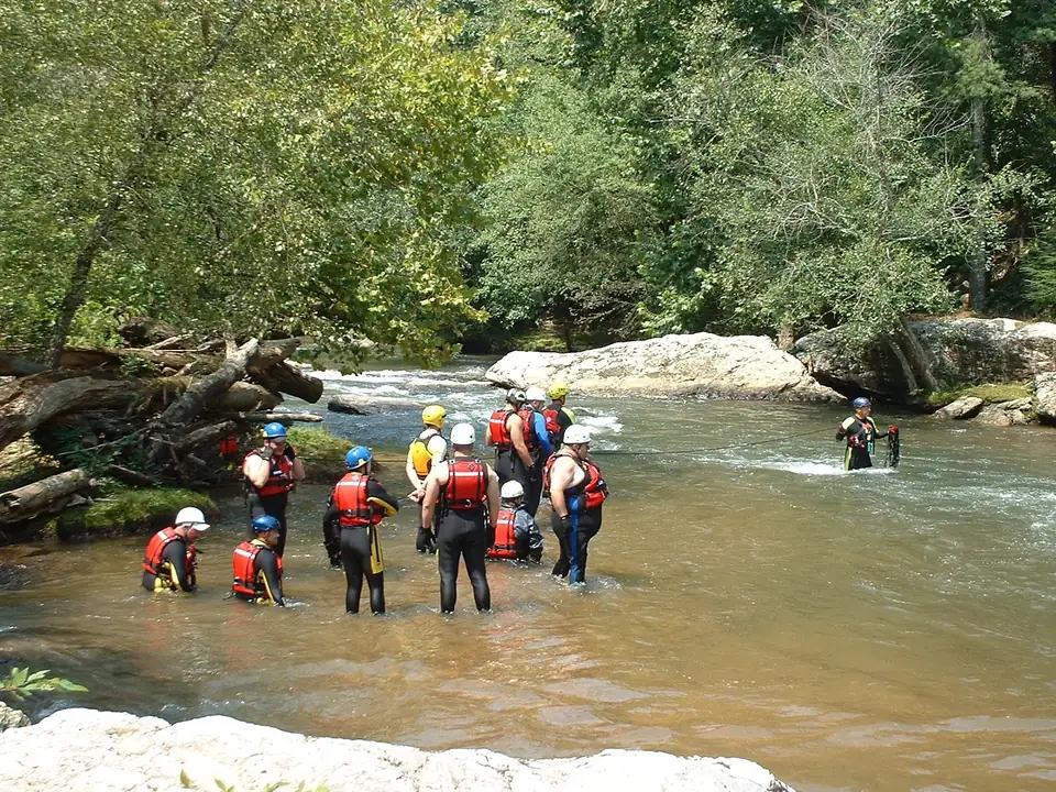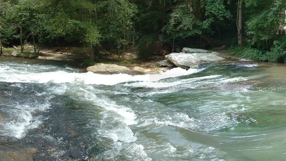
Private landowners own nearly all of it. The Cartecay River runs about 19 miles through eastern Gilmer County, Georgia, and almost every source that speaks to access says the same thing: the land on both sides belongs to someone. The one public launch an official source confirms is Georgia DNR’s canoe and kayak launch on the Rich Mountain WMA Cartecay Tract. Everything else is either a private business serving its customers or a spot nobody official has called public.
What the people closest to the river say
The tubing outfitter is the bluntest. Cartecay River Experience tells tubers there are no places to get out along its float because both sides of the Cartecay are privately owned. Its Adventure float page says riders may not stop on the banks, and that “You MUST keep floating” (Cartecay River Experience).
The paddling reference agrees. American Whitewater says most of the Middle Cartecay runs through a residential area, most banks are private property, and there are no restrooms once you put in. It asks paddlers to keep groups small and quiet, not linger at any one spot, not put on after dark, and respect the homeowners (American Whitewater).
The state says it in general terms. Georgia DNR warns that many trout streams are on private property, that anglers are responsible for knowing when they cross a property line, and that they need landowner permission before entering or fishing private land. Georgia Wild Trout, a guide service, adds that above Highway 52 the river runs entirely through private land up to its source (Georgia Wild Trout).
None of these sources is a court, and none of them settles the legal question of who may float or wade a given stretch. That is a question for a lawyer. What they do tell you is how the river is managed day to day, and that is the part a visitor needs.
Why tubers have to keep floating
The outfitter runs two floats. The Adventure float puts in at 1554 Lower Cartecay Road and the Lazy River float at its base, 2400 Hwy 52 East (Cartecay River Experience). Between the put-in and the take-out, the banks belong to private owners. That is why the outfitter writes the keep-floating rule in capital letters.
Missing the take-out is the other trap. The outfitter says that if Adventure floaters miss the designated take-out, the next one is roughly 6 to 8 hours downriver (Cartecay River Experience). With private land on both sides, there is no easy walk out.
The same outfitter says a county ordinance bans coolers and glass on the river, and allows one 32-ounce non-alcoholic drink and a small dry bag (Cartecay River Experience). We could not find the ordinance text on an official county site, so read that as the outfitter’s rule, stated in its own words. Its rental season runs Memorial Day to Labor Day (Cartecay River Experience); our tubing guide has the rest.
The one confirmed public launch
The Rich Mountain WMA Cartecay Tract is a 2,142-acre Georgia DNR property in Gilmer County (Georgia DNR). DNR lists canoe access among its facilities and canoeing and river fishing among its activities (Georgia DNR). Its tract map, revised July 29, 2021, marks a canoe and kayak launch reached by Canoe Launch Road off Highway 52 (DNR map).
Georgia Rivers calls it a DNR launch site and a state-maintained access (Georgia Rivers). Its directions: take Ga. 52 east from Ellijay, turn right on Canoe Launch Road (look for signs for the Gilmer County Animal Shelter) and go 0.8 mile (Georgia Rivers). Do not use the street address on DNR’s WMA page for directions; it appears to be a general Rich Mountain WMA contact, not the launch.
You need a Georgia hunting license, fishing license or Lands Pass to use the tract (Georgia DNR). The launch sits at about river mile 13.9 on our profile. It is the take-out for American Whitewater’s Lower Cartecay, and Paddle Georgia started its 2026 trip there (Georgia Rivers).
Bridges and other spots that get called access
Road bridges cross the Cartecay at Holt Bridge Road, Highway 52 East, US 76/GA 515 and First Avenue in Ellijay, and Blackberry Mountain Road crosses Clear Creek near its mouth. Georgia Wild Trout says trout are stocked “along the bridges” (Georgia Wild Trout). We found no official source that names any of these bridges as public access, so we do not list them as access.
Three other spots come up often. American Whitewater uses the Lower Cartecay Road bridge as its Middle Cartecay put-in and says the river-left put-in there is managed by a commercial outfitter (American Whitewater). A trip report and OpenStreetMap both say that bridge is out, and we could not confirm that it has reopened, so do not plan to drive across it. The Mulkey Road take-out below Blackberry Falls has limited parking and a lot that AW says is closed Friday through Monday from May 15 to September 15 (American Whitewater); we could not confirm who owns it. Our piece on the Mulkey Road take-out sorts out its several names.
There was once a free put-in. In 2001 American Whitewater reported that River Right Outfitters, with its help, had leased a free public put-in on the Cartecay (American Whitewater). That arrangement is history; do not count on it today.
What it means for anglers
DNR stocks the Cartecay, but it does not publish the spots, and stocked water running past private land is still private land. Fish the DNR tract with your license, get a landowner’s permission somewhere else, or book a guide with private water. Reel ‘Em In Guide Service guides catch-and-release fly fishing on a private half mile of the Cartecay on a 200-acre farm (Reel ‘Em In). The full picture is in trout fishing the Cartecay.
What it means if you own riverfront
If you own land on the outfitter’s stretch, summer brings floaters past your bank, and the outfitter tells them to keep moving. The rules that shape what you can do on that bank come from the state and the county.
The big one is the stream buffer. Georgia’s baseline buffer is 25 feet along all state waters (Georgia EPD), but along waters classified as trout streams it is 50 feet (Georgia EPD). The Cartecay is designated trout water, primary above Clear Creek and secondary below it, so the 50-foot buffer is the one that generally applies along it (Georgia EPD rules). In Gilmer County, land disturbance inside that buffer needs an Application for a 50 Foot Vegetative Buffer Encroachment filed with EPD (Gilmer County). Someone building a single-family home for their own use may thin or trim buffer vegetation if enough cover and canopy remain to shade the stream (Gilmer County).
Building in a floodplain needs a county permit, and FEMA’s Flood Map Service Center is the official source for flood maps (FEMA). Every one of these questions is parcel by parcel. Gilmer County Planning & Zoning, at 1 Broad Street, Suite 002, in Ellijay (706-635-3406), is where to confirm yours (Gilmer County). Our living on the Cartecay guide goes further, and the checklist below covers the basics.
Decision tool · riverfront buyers
Before you buy on the Cartecay: 13 things to settle
Riverfront here is private land with state buffers, flood maps and county permits attached. Tick each question off as you get a real answer from the office named. Your progress stays in this browser only.
All 13 settled. Gold Peach Realty can walk you through homes near the Cartecay and what each one's frontage, flood map and permits look like.
Rules change: each answer links to the office or agency that publishes it, checked October 18, 2026. This checklist is general information, not legal, survey or insurance advice.
If you own land on the Cartecay and are thinking about selling, Gold Peach Realty can walk you through the questions buyers ask about river frontage, buffers and flood maps. You can also start from our sell your home page.
Questions people ask
Are the banks of the Cartecay River public?
Almost entirely no. Cartecay River Experience says both sides of the river are privately owned along its floats, and American Whitewater says most banks on the Middle Cartecay are private property. The one public launch an official source confirms is Georgia DNR's canoe and kayak launch on the Rich Mountain WMA Cartecay Tract.
Source: Cartecay River Experience, checked Oct 18, 2026
Can you stop on the bank while tubing the Cartecay?
Not on the outfitter's floats. Cartecay River Experience says riders may not stop on the banks, which are private property, and that they must keep floating. It also says that if you miss the Adventure take-out, the next one is roughly 6 to 8 hours downriver.
Source: Cartecay River Experience, checked Oct 18, 2026
Is there public access to the Cartecay River?
Yes, at one confirmed spot: the Georgia DNR canoe and kayak launch on the Rich Mountain WMA Cartecay Tract, at the end of Canoe Launch Road off Ga. 52. You need a Georgia hunting license, fishing license or Lands Pass to use the tract.
Source: Georgia DNR WRD, checked Oct 18, 2026
Is a bridge over the Cartecay public access?
No official source we found calls any Cartecay bridge public access. Georgia Wild Trout says trout are stocked along the bridges, but that is a guide service's description of stocking, not a statement about access.
Source: Georgia Wild Trout, checked Oct 18, 2026
Written by the Cartecay River Guide Editorial Team. AI tools help us draft; people check every fact before it publishes.