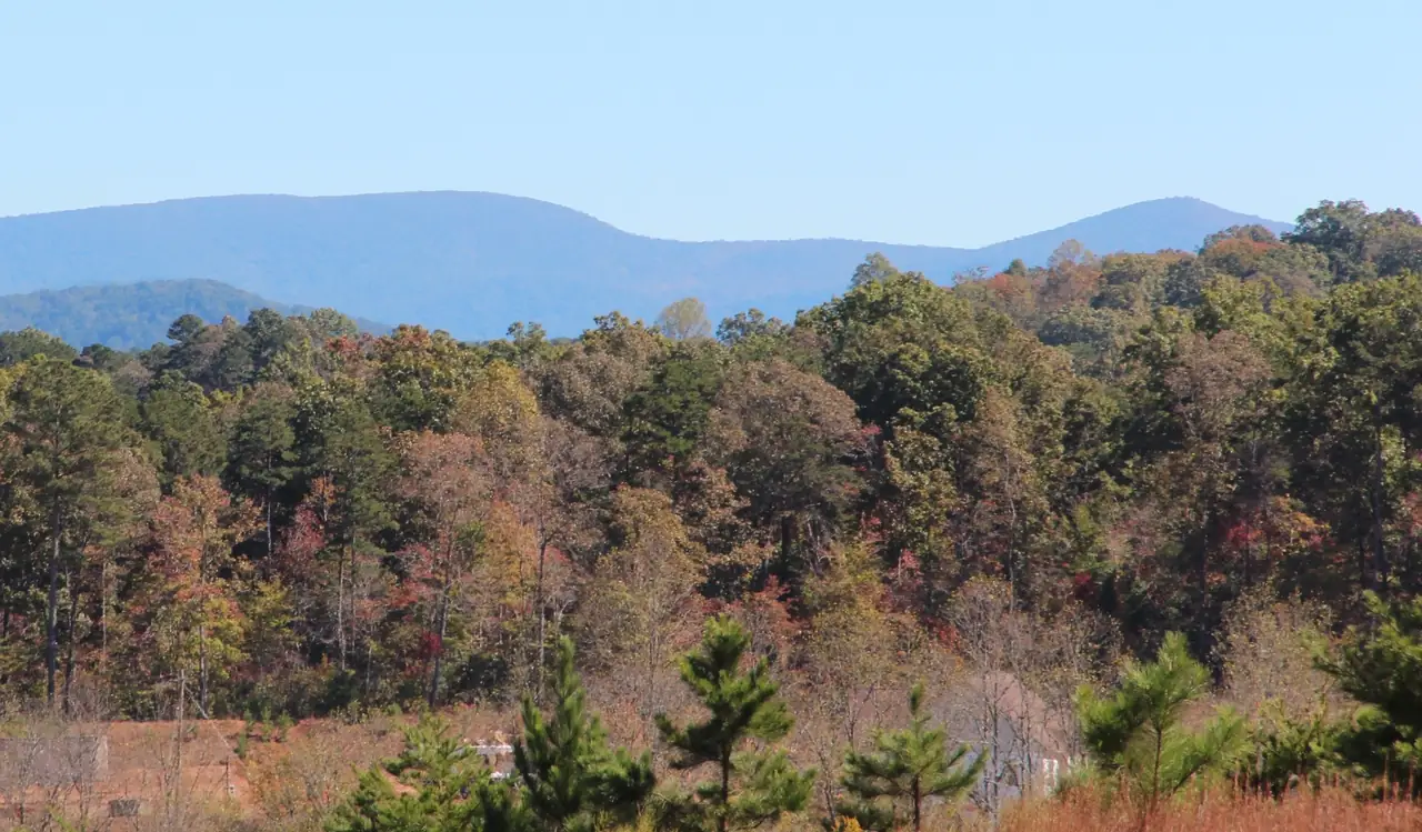
This Cartecay River map shows the whole river in Gilmer County, Georgia, from the junction of Tickanetley and Rolston creeks in the east to the confluence with the Ellijay River in downtown Ellijay. Every pin is a place a source describes. Tap one for its card, or use the numbered list under the map.
River, creeks and roads from OpenStreetMap. Most of the Cartecay's banks are private land: a pin marks a place a source describes, not permission to cross private property. A guide, not a navigation chart.
-
Private land: no public access
Where Tickanetley and Rolston creeks join to form the Cartecay, near the Rolston community; private land, no public access.
River mile: 0.0 (measured along the mapped river from its upstream end)
Source: USGS GNIS; OpenStreetMap, checked Oct 18, 2026 · Open in a map
-
Access not confirmed
County road bridge (CR 120) over the upper Cartecay; no official source names it as a stocking point or public access.
River mile: 4.1 (measured along the mapped river from its upstream end)
Source: OpenStreetMap, checked Oct 18, 2026 · Open in a map
-
Access not confirmed
State highway bridge over the upper Cartecay; Georgia Wild Trout says trout are stocked along the river's bridges, but no official source names this bridge as a stocking point or public access.
River mile: 5.5 (measured along the mapped river from its upstream end)
Source: OpenStreetMap, checked Oct 18, 2026 · Open in a map
-
Access not confirmed
American Whitewater names this bridge as the Middle Cartecay put-in and says a river-left put-in here is run by a commercial outfitter; no official source calls it public access, and OSM marks the bridge closed.
River mile: 6.8 (measured along the mapped river from its upstream end)
Source: American Whitewater, checked Oct 18, 2026 · Open in a map
-
Access not confirmed
American Whitewater's take-out for the Middle Cartecay and put-in for the Lower, just below Blackberry Falls on river right; parking is limited and the lot is closed Friday-Monday in summer. Ownership/public status not confirmed by an official source.
Season: AW: parking lot closed Friday-Monday, May 15-Sept 15
River mile: 9.1 (measured along the mapped river from its upstream end)
Source: American Whitewater, checked Oct 18, 2026 · Open in a map
-
Access not confirmed
Georgia Wild Trout says Clear Creek is stocked at the Blackberry Mountain Bridge; American Whitewater uses it as the Clear Creek put-in. Not confirmed as public access by an official source.
River mile: 11.0 (measured along the mapped river from its upstream end)
Source: Georgia Wild Trout; American Whitewater; OpenStreetMap, checked Oct 18, 2026 · Open in a map
-
Access not confirmed
Clear Creek joins the Cartecay at the base of Clear Creek Falls, the Lower Cartecay's Class III rapid (American Whitewater).
River mile: 11.0 (measured along the mapped river from its upstream end)
Source: American Whitewater, checked Oct 18, 2026 · Open in a map
-
Public land or a public facility (per its source)
DNR wildlife management area beside the river with hiking, biking and horse trails, archery hunting (deer and bear archery only), river fishing and canoe access; trails close before 10 a.m. in deer, bear and turkey seasons.
Fees: Hunting license, fishing license, or Lands Pass
River mile: 13.8 (measured along the mapped river from its upstream end)
Source: Georgia DNR, checked Oct 18, 2026 · Open in a map
-
Public land or a public facility (per its source)
The one state-run public access on the Cartecay: a Georgia DNR canoe/kayak launch on the 2,142-acre Cartecay Tract, used as the take-out for the Lower Cartecay and as the Paddle Georgia 2026 start.
Fees: Georgia hunting license, fishing license, or Lands Pass required for land access
River mile: 13.9 (measured along the mapped river from its upstream end)
Source: Georgia DNR WRD Cartecay Tract page and map; Georgia Rivers Paddle Georgia 2026 page, checked Oct 18, 2026 · Open in a map
-
Access not confirmed
The live flow and stage gauge for the Cartecay, on Ga. 52 at the East Ellijay city limits; not an access point.
River mile: 17.3 (measured along the mapped river from its upstream end)
Source: USGS, checked Oct 18, 2026 · Open in a map
-
Private business: open to its customers
An adults-only downtown bed and breakfast with river decks. It sits on the ELLIJAY River (not the Cartecay), just upstream of where the two rivers meet.
River mile: 19.1 (measured along the mapped river from its upstream end)
Source: Ellijay River House (own site), checked Oct 18, 2026 · Open in a map
-
Private business: open to its customers
Buckley Vineyards' downtown restaurant steps from the square, pouring the vineyard's wines and cider with chef-designed shareables and entrees; reservations or walk-ins.
River mile: 19.1 (measured along the mapped river from its upstream end)
Source: Buckley Downtown Table & Vine (own site), checked Oct 18, 2026 · Open in a map
-
Private business: open to its customers
A wood-fired pizza restaurant opened in November 2018 at the corner of River and Main streets on the downtown square.
River mile: 19.1 (measured along the mapped river from its upstream end)
Source: Ellijay Wood Fired Pizza (own site), checked Oct 18, 2026 · Open in a map
-
Access not confirmed
Where the Cartecay ends and, with the Ellijay River, forms the Coosawattee; the Cherokee town that preceded Ellijay stood here. No official public river access point is published at the confluence.
River mile: 19.2 (measured along the mapped river from its upstream end)
Source: City of Ellijay; USGS GNIS; OpenStreetMap, checked Oct 18, 2026 · Open in a map
-
Public land or a public facility (per its source)
The Gilmer County Chamber's downtown welcome center on the Ellijay square; the chamber's main office and welcome center is at 696 First Avenue, East Ellijay (706-635-7400, Mon-Fri 9-5).
River mile: 19.2 (measured along the mapped river from its upstream end)
Source: Gilmer County Chamber, Contact page, checked Oct 18, 2026 · Open in a map
-
Public land or a public facility (per its source)
A late-1800s Victorian house just off the square, run by the Gilmer County Historical Society as a museum of Cherokee, early-settler, Civil War and local history.
Season: Open March 19 to December 5, 2026 (homepage banner also says mid-March through mid-December)
Fees: Free admission; donations welcome
River mile: 19.2 (measured along the mapped river from its upstream end)
Source: Gilmer County Historical Society (Tabor House) homepage, checked Oct 18, 2026 · Open in a map
-
Private business: open to its customers
A family orchard growing apples since 1946, about 9 miles east of Ellijay on Hwy 52, with U-pick, weekend farm activities and a farm market.
Source: Hillcrest Orchards (own site, Hours & Directions), checked Oct 18, 2026 · Open in a map
-
Private business: open to its customers
A family orchard on Hwy 52 East with a year-round farm market and bakery and fall U-pick apples and farm activities; closed Thanksgiving, Christmas Eve, Christmas Day and Easter.
Season: Market and bakery year-round; 2026 U-pick began August 29, open 7 days a week in September and October
Source: BJ Reece Orchards (own site), checked Oct 18, 2026 · Open in a map
-
Private business: open to its customers
A roadside apple house on Hwy 52 East; the Gilmer Chamber says it has sold apples since 1944. Its one-page site still carries curbside-pickup wording and no date, so current hours are not confirmed.
Season: Open all year (per own site)
Source: Mack Aaron's Apple House (own site), checked Oct 18, 2026 · Open in a map
-
Private business: open to its customers
An estate winery on Clear Creek Road (Clear Creek is a Cartecay tributary) with 14 acres of vines, a tasting barn and live music every Saturday and Sunday; all its wines are made from its own grapes.
Source: Cartecay Vineyards (own site, Find Us), checked Oct 18, 2026 · Open in a map
-
Private business: open to its customers
A family orchard on Hwy 52 East with a year-round market, bakery and cafe, plus fall U-pick apples and flowers.
Season: Market, bakery and cafe year-round; U-pick every weekend through October (2026)
Source: R and A Orchards (own site, contact page), checked Oct 18, 2026 · Open in a map
-
Public land or a public facility (per its source)
25.94-acre City of Ellijay park on the former Pinson farm. It sits beside the Ellijay River (about 100 m) and about 1.1 km from the Cartecay, so it is not Cartecay access.
Source: City of Ellijay – Harrison Park; OpenStreetMap, checked Oct 18, 2026 · Open in a map
-
Private business: open to its customers
A family fruit farm dating to the 1920s with a farm market, bakery and homemade ice cream. It is on Hwy 515 south of Ellijay, NOT on the Cartecay/Hwy 52 corridor.
Season: Apples all fall and into winter; peaches May to late August
Source: Panorama Orchards (own site, directions), checked Oct 18, 2026 · Open in a map
-
Access not confirmed
Live gauge on the Coosawattee below the Cartecay-Ellijay confluence (236 sq mi); context only, not on the Cartecay.
Source: USGS, checked Oct 18, 2026 · Open in a map
How to read the map
Pins run downstream, starting at the creek junction where the Cartecay begins and heading west past the bridges, American Whitewater’s put-in and take-out, the DNR launch and the USGS gauge to downtown Ellijay. Places away from the river come after them: the orchards on Hwy 52 East, Cartecay Vineyards on Clear Creek Road, Harrison Park and the Coosawattee gauge below town. Arrows at the edge point toward a few that sit off the map. The filter buttons trim the view.
Each pin sits where OpenStreetMap or the place’s own source puts it. If we couldn’t find a published point, we left the place off rather than guess. That is why Cartecay River Experience’s two put-ins aren’t pinned: neither street address matched a mapped point. You’ll find both addresses on the tubing page.
The river line, creeks and roads are drawn from OpenStreetMap data. The map shows no rapids, depths or hazards, so use it to plan, not to navigate.
Private banks between the pins
Most of the Cartecay’s banks are private land, and a pin marks a place a source describes, not permission to cross anyone’s property. The only public launch an official source confirms is the canoe access Georgia DNR lists on its Rich Mountain WMA Cartecay Tract (Georgia DNR WRD). Bridges are pinned because people ask about them. None is confirmed as public access. Our page on where the public can get on gives the status of each spot.
River miles and the long profile
River miles are measured along the mapped river line, starting at its upstream end where Tickanetley Creek’s mapped line stops. Measured that way for this guide, the line is 19.2 miles long. The river is usually given as 19.1 miles (Wikipedia), so call it about 19 miles.
USGS elevation data put the ground at the river’s start at about 1,579 feet (USGS 3DEP), and USGS gives 1,240 feet for its site at the mouth (USGS): a drop of roughly 340 feet. Our profile, measured for this guide from USGS 3D Elevation Program data, agrees, with about 1,572 feet at mile 0, about 1,234 feet at the confluence and a fall of about 338 feet. The stations on the profile below are the same places as the river pins, in the same order.
- 0.0river mileTickanetley-Rolston confluence (head of the Cartecay) Tickanetley and Rolston creeks join and the Cartecay begins (USGS GNIS). Private land.
- 4.1river mileHolt Bridge Road bridge over the Cartecay
- 5.5river mileHighway 52 East bridge over the Cartecay (near Cartecay community)
- 6.9river mileLower Cartecay Road bridge (American Whitewater Middle Cartecay put-in) American Whitewater's Middle Cartecay put-in; the river-left put-in is run by a commercial outfitter.
- 9.1river mileMulkey Road take-out at the Blackberry Mountain Drive bridge (Stegall Mill Road / "Blackberry") Take-out below Blackberry Falls per American Whitewater; parking limited, ownership not confirmed.
- 11.0river mileClear Creek confluence (base of Clear Creek Falls) Clear Creek joins; upstream of here the watershed is Primary Trout Waters.
- 13.9river mileRich Mountain WMA: Cartecay Tract canoe/kayak launch (DNR / "WMA take-out") Georgia DNR canoe/kayak launch on the Rich Mountain WMA Cartecay Tract: the one public launch an official source confirms. License or Lands Pass required.
- 17.3river mileUSGS gauge 02379500, Cartecay River near Ellijay USGS 02379500, the flow reading on this site.
- 19.2river mileCartecay-Ellijay confluence (start of the Coosawattee River) Meets the Ellijay River; the Coosawattee begins.
One take-out, several names
The take-out below Blackberry Falls goes by more than one name. American Whitewater’s section titles call it Stegall Mill Road, while its directions call it the Mulkey Road take-out (American Whitewater), and OpenStreetMap names the bridge there Blackberry Mountain Drive. All three point to the pin near mile 9.1. A Stegall Mill did stand beside the Cartecay: the New Georgia Encyclopedia shows it in a 1939 photograph, milling both lumber and wheat (New Georgia Encyclopedia).
Where the map ends
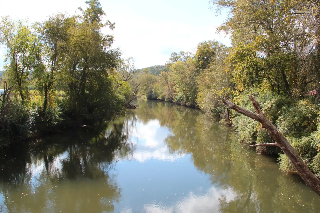
The river ends in downtown Ellijay. USGS places the Cartecay’s mouth at the same point where the Ellijay River ends and the Coosawattee River begins (USGS GNIS). No official source publishes a public spot to reach the water there. The photo below shows the Coosawattee just downstream of the meeting point.
Read more in where the Cartecay River starts and ends and Cartecay, Ellijay or Coosawattee: which river is it. For the runs and the gauge, see kayaking and paddling and water levels and safety.
Questions people ask
Is it Cartecay or Cartercay?
Cartecay. Cartecay River is the official USGS name, from an 1897 Board on Geographic Names decision; "Cartercay" is a common misspelling of it.
Source: USGS GNIS, checked Oct 18, 2026
How long is the Cartecay River?
About 19 miles. It is usually given as 19.1 miles, which Wikipedia attributes to the USGS National Hydrography Dataset, and the mapped river line we measured for this guide comes to 19.2 miles.
Source: Wikipedia, checked Oct 18, 2026
Where does the Cartecay meet the Ellijay River?
In Ellijay. The City of Ellijay describes the town as lying between the Ellijay and Cartecay rivers, where they join to make the Coosawattee River.
Source: City of Ellijay, checked Oct 18, 2026
How much does the Cartecay River drop?
About 340 feet. USGS elevation data put its start, at the junction of Tickanetley and Rolston creeks, at about 1,579 feet, and USGS gives 1,240 feet at its mouth in Ellijay.
Source: USGS 3DEP, checked Oct 18, 2026