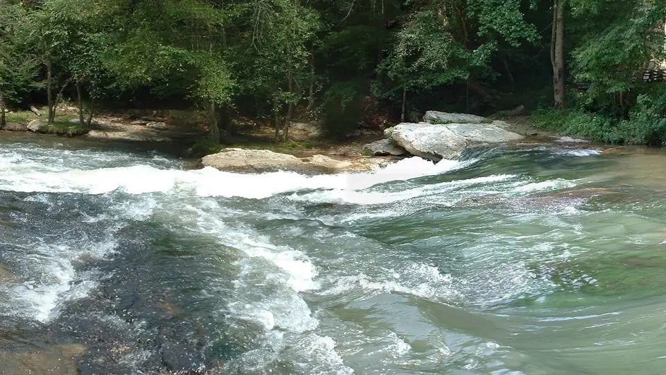
Kayaking the Cartecay River in Gilmer County, Georgia, comes in two forms. In summer you can rent a kayak from Cartecay River Experience and float one of its two routes. Paddlers with their own boats and whitewater skills run the two sections American Whitewater (AW) describes, the Middle and Lower Cartecay. Rentals are closed now: the season runs Memorial Day to Labor Day (Cartecay River Experience).
Rental kayaks: the outfitter’s two floats
Kayaks rent for $30 cash or $34 by card for either float, shuttle included, as listed on the outfitter’s website (no year printed, checked October 18, 2026) (Cartecay River Experience). Kayakers must be 10 or older (Cartecay River Experience). The Adventure float covers about 3 miles of what the outfitter calls Class 1 and 2 whitewater and takes roughly 1.5 to 2 hours by kayak (Cartecay River Experience). The calm Lazy River float is about 1.5 miles. Have your own kayak? The outfitter’s shuttle alone costs $7 cash or $10 by card per person (Cartecay River Experience). Its rules, including the no-cooler policy, are on our tubing page.
The whitewater runs, per American Whitewater
Every class rating and level range in this section is AW’s, not ours. Levels refer to USGS gauge 02379500 near Ellijay.
| Section (AW) | Put-in to take-out | Class | Length | AW recommended range |
|---|---|---|---|---|
| Middle Cartecay | Lower Cartecay Road bridge to the Mulkey Road take-out below Blackberry Falls | I-II+ (III) | 2.3 miles, averaging 28 feet per mile | 1.8 to 6 feet |
| Lower Cartecay | Mulkey Road take-out to the DNR take-out on the Rich Mountain WMA | II (III) | 4.7 miles | 2.2 to 6 feet |
Sources: American Whitewater (Middle) and American Whitewater (Lower), checked October 18, 2026. AW’s section titles name Stegall Mill Road as the break between the runs, while its directions put that take-out at Mulkey Road, just past the bridge below Blackberry Falls. On the profile we measured for this guide, the Lower Cartecay Road bridge sits near river mile 6.8, the Mulkey Road take-out near mile 9.1 and the DNR launch near mile 13.9.
Middle Cartecay
AW’s named rapids on this run are Sexton’s, Rock Garden, Surfing Rapid, S-Turn, Whirlpool and Blackberry Falls, and S-Turn becomes Class III at 4 to 6 feet (American Whitewater). AW warns that the river-right eddy at Whirlpool almost always holds wood, strainers or other debris, and that the rapid becomes Class III/III+ above 4 feet (American Whitewater). Blackberry Falls, the last rapid, is Class II and rises to Class III/III+ above 4 feet, per AW.
AW says to put in at the Lower Cartecay Road bridge, where a river-left put-in is managed by a commercial outfitter (American Whitewater). OpenStreetMap marks that bridge closed, and we could not confirm it has reopened, so don’t plan a shuttle that drives across it.
The take-out is at Mulkey Road, just past the bridge below Blackberry Falls on river right. AW says parking is limited and that the lot is closed Friday through Monday from May 15 to September 15 (American Whitewater). We could not confirm who owns the lot. Our article on Blackberry Falls and the Mulkey Road take-out untangles its several names.
Lower Cartecay
Below Mulkey Road the river runs 4.7 miles to the DNR take-out. Clear Creek Falls, about 3 miles down, is the section’s one Class III rapid (American Whitewater), at the spot where Clear Creek comes in. AW says that at 2.4 feet or more it is worth carrying on past Mulkey Road to the DNR take-out (American Whitewater). That take-out is the Georgia DNR canoe and kayak launch on the Rich Mountain WMA Cartecay Tract, the one public launch an official source confirms. To use the tract you need a Georgia hunting license, fishing license or Lands Pass (Georgia DNR WRD). Directions are on our access page.
The same launch started Paddle Georgia 2026. Georgia Rivers described its June 14 opening day as an 11-mile run from the Cartecay inside the WMA, past riverfront cabins, over Class I shoals and one portage-able Class II rapid, to the Ellijay River (Georgia Rivers). The trip ended June 20 in Rome after seven days and 95 miles, with about 360 participants.
Check the gauge, and remember where it is
AW’s ranges refer to USGS gauge 02379500, which sits downriver of both runs, near mile 17.3 on our profile. AW cautions that because the gauge is downstream, it matters whether the level is rising or falling, and it suggests checking the shoals at the Mulkey Road take-out when the reading is near the minimum (American Whitewater). A reading inside AW’s range is not a promise of anything. Whether to launch is your call, and on a rental trip it is the outfitter’s. Our water levels and safety page explains the numbers.
Cartecay River flow now
109 cfs
Close to the usual October flow.
Gage height 1.45 ft. American Whitewater lists 1.8 to 6 ft for the Middle Cartecay; this reading is below that range. Reading taken Oct 18, 8:15 PM ET. Provisional data. Source: USGS gage 02379500 · What it means for a trip
The profile below traces the river’s fall from the creek junction at mile 0 to Ellijay, with the put-in, take-outs and gauge marked by river mile. The river map shows the same places from above.
- 0.0river mileTickanetley-Rolston confluence (head of the Cartecay) Tickanetley and Rolston creeks join and the Cartecay begins (USGS GNIS). Private land.
- 4.1river mileHolt Bridge Road bridge over the Cartecay
- 5.5river mileHighway 52 East bridge over the Cartecay (near Cartecay community)
- 6.9river mileLower Cartecay Road bridge (American Whitewater Middle Cartecay put-in) American Whitewater's Middle Cartecay put-in; the river-left put-in is run by a commercial outfitter.
- 9.1river mileMulkey Road take-out at the Blackberry Mountain Drive bridge (Stegall Mill Road / "Blackberry") Take-out below Blackberry Falls per American Whitewater; parking limited, ownership not confirmed.
- 11.0river mileClear Creek confluence (base of Clear Creek Falls) Clear Creek joins; upstream of here the watershed is Primary Trout Waters.
- 13.9river mileRich Mountain WMA: Cartecay Tract canoe/kayak launch (DNR / "WMA take-out") Georgia DNR canoe/kayak launch on the Rich Mountain WMA Cartecay Tract: the one public launch an official source confirms. License or Lands Pass required.
- 17.3river mileUSGS gauge 02379500, Cartecay River near Ellijay USGS 02379500, the flow reading on this site.
- 19.2river mileCartecay-Ellijay confluence (start of the Coosawattee River) Meets the Ellijay River; the Coosawattee begins.
Private banks and AW’s etiquette
AW says most of the Middle Cartecay runs through a residential area, most banks are private property, and there are no restrooms once you put in (American Whitewater). It asks paddlers to keep groups small and quiet, not linger at any one spot, not put on after dark, and respect the homeowners (American Whitewater). Plan your stops for the put-in and the take-out.
Georgia rules for paddlers
- Every person aboard needs a wearable life jacket (PFD) that is US Coast Guard approved, the right size, in good condition and within easy reach (GA eRegulations).
- Children under 13 must wear a life jacket while the boat is under way.
- Canoes and kayaks are exempt from the throwable-device requirement.
- Paddle-only canoes and kayaks need no registration. Only boats with mechanical propulsion, electric trolling motors included, and sailboats 12 feet or longer must be registered.
- Georgia law prohibits operating any boat while intoxicated (GA DNR LED).
Questions people ask
Can you rent a kayak on the Cartecay River?
Yes, in season. Cartecay River Experience rents kayaks to paddlers 10 and older for $30 cash or $34 by credit card, either float, shuttle included, as listed on its website with no year printed (checked October 18, 2026).
Source: Cartecay River Experience, checked Oct 18, 2026
How hard is the whitewater on the Cartecay River?
American Whitewater lists the Middle Cartecay, from Lower Cartecay Road to the take-out below Blackberry Falls, as Class I-II+ (III) over 2.3 miles. Blackberry Falls, the last rapid, is Class II and rises to Class III/III+ above 4 feet.
Source: American Whitewater, checked Oct 18, 2026
What water level do you need to paddle the Cartecay?
American Whitewater's recommended range for the Middle Cartecay is 1.8 to 6 feet on USGS gauge 02379500. It also says that at 2.4 feet or more it is worth continuing past the Mulkey Road take-out to the DNR take-out.
Source: American Whitewater, checked Oct 18, 2026
Where do you take out after Blackberry Falls?
American Whitewater puts the take-out at Mulkey Road, just past the bridge below Blackberry Falls on river right. It says parking is limited and the lot is closed Friday through Monday from May 15 to September 15.
Source: American Whitewater, checked Oct 18, 2026
Do you have to register a kayak in Georgia?
No. Georgia requires registration only for boats with mechanical propulsion, including electric trolling motors, and sailboats 12 feet or longer, so paddle-only canoes and kayaks are exempt. Every paddler still needs a wearable life jacket.
Source: GA eRegulations, checked Oct 18, 2026